Overview, Directions, and Timing
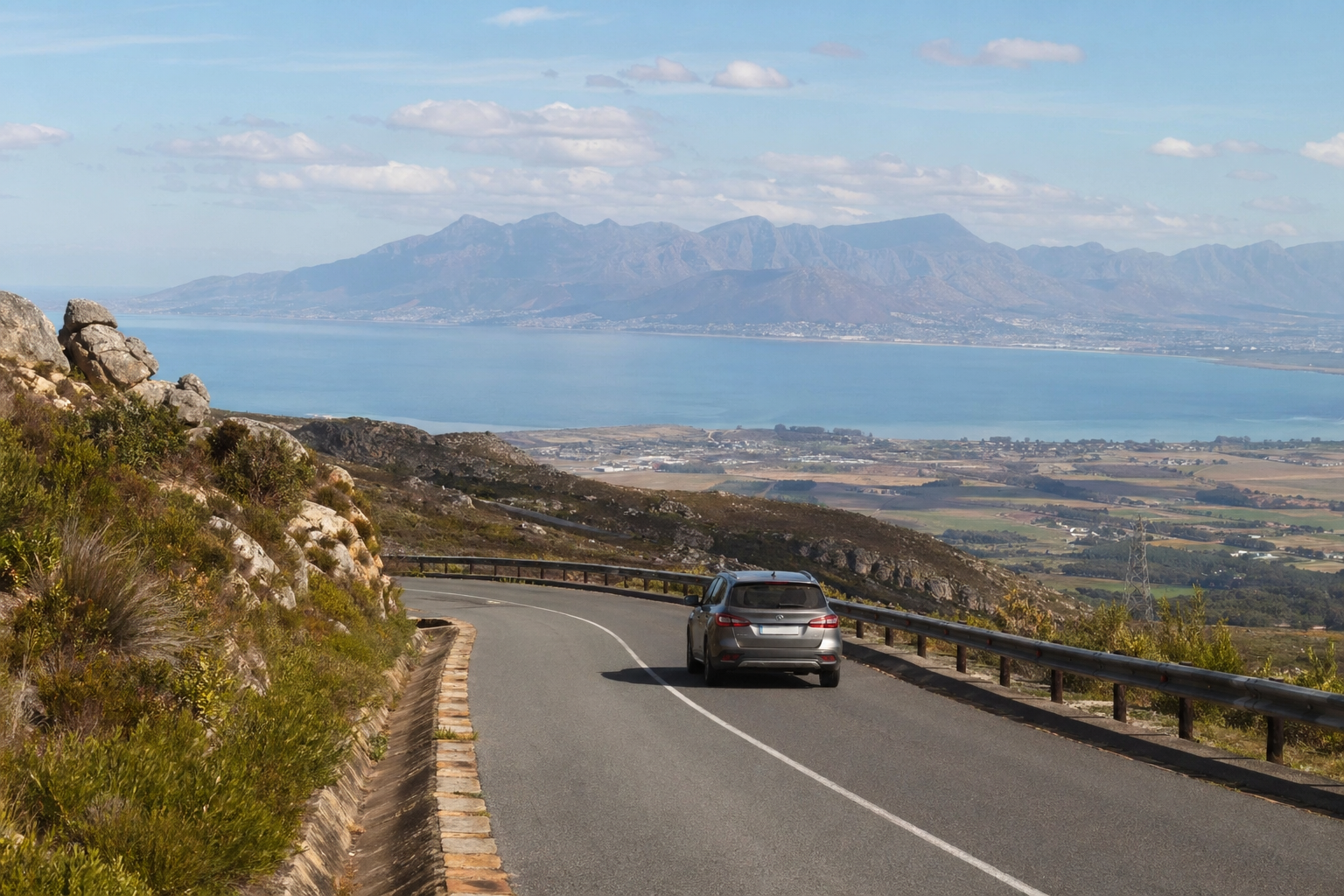
The moment the N2 tilts upward past Somerset West and the Hottentots Holland mountains fill your windscreen, you know Sir Lowry’s Pass has started. Tightening bends, steep drop-offs, and panoramic views of False Bay open up within the first few kilometres, and the whole thing is over in roughly ten minutes if you don’t stop.
The pass connects the Cape Town side of the Hottentots Holland range to the Elgin Valley and the town of Grabouw on the other side. If you’re driving from Cape Town, take the N2 southeast through Somerset West, the climb begins just past the Gordons Bay turnoff. From the Overberg direction, you’ll encounter the pass shortly after leaving Grabouw heading west. Total distance from central Cape Town to the foot of the pass is roughly 50 kilometres, usually 40 to 55 minutes depending on traffic.
Timing matters. Early mornings on weekdays give you lighter traffic, cleaner air, and the best light for photographs on the Cape Town side. Weekend mornings can be busy with day-trippers heading to Elgin farm stalls. Late afternoon drives back toward Cape Town put the sun behind you and light up False Bay beautifully, but Friday afternoons are best avoided, commuter traffic and trucks stack up on the climb. Winter brings low cloud and occasional rain that can cut visibility sharply, so check conditions before you set out.
Road Conditions and Elevation
Sir Lowry’s Pass road conditions are genuinely good. The surface is well-maintained tar with clear lane markings, Armco barriers on the exposed corners, and rumble strips separating opposing lanes on much of the climb. There are two lanes in each direction for part of the ascent, a dedicated crawler lane for heavy vehicles, which makes overtaking slower trucks straightforward and legal. Signage is frequent and clear, gradient warnings, recommended speeds for bends, and distance markers are all present.
The Sir Lowry’s Pass elevation gain is notable. You climb from near sea level on the Somerset West side to roughly 390 metres at the summit in a short stretch of road. That means sustained gradients and tight curves. In a modern car with a healthy cooling system, this is a non-event. Just stay in a gear that keeps the engine in a comfortable rev range on the way up, and use engine braking on the descent rather than riding your brakes the whole way down. If you’re towing a trailer or driving something heavily loaded, the crawler lane is there for a reason, use it without embarrassment, and keep an eye on your temperature gauge.
Weather at the top can differ dramatically from conditions at the base. Cloud can roll in fast, and when it does, visibility drops. Headlights on, speed down, and increase your following distance. In winter rain, the road drains well, but standing water can gather at the base of corners. None of this requires a 4×4 or anything special, an everyday hatchback or sedan handles the pass comfortably in dry or wet conditions.
Scenic Views Both Directions
The Sir Lowry’s Pass scenic drive rewards attention from the first bend. Heading from Somerset West, the road rises quickly and the coastal plain opens behind you. False Bay stretches out to the south, with the Strand and Gordons Bay harbour visible below. On clear days, the view extends to the Kogelberg mountains across the bay and sometimes as far as Cape Hangklip.
As you gain height, the fynbos-covered slopes press in on both sides. The rock cuts through the mountain are layered sandstone, ancient geology exposed by road engineers. Near the summit, the pass levels briefly and the landscape shifts. The descent into the Elgin Valley is gentler, greener, and distinctly cooler. Orchards and farmland replace the coastal scrub. The transition feels sudden, almost like crossing into a different climate zone, because in a real sense you are.
Driving it in the Grabouw-to-Somerset-West direction reverses the drama. You climb through farmland and forest, crest the summit, and then the full sweep of False Bay and the Cape Flats appears below, arguably the more dramatic reveal.
Either direction works. If you’re making a loop from Cape Town through Franschhoek or Stellenbosch and returning via the N2, you’ll get both perspectives in a single day.
Viewpoints, Shops, and Baboons
The most popular viewpoint is the large pull-off area near the top of the pass on the Cape Town side, marked with signage. It’s paved, has space for several cars, and puts you right at the edge of the view over False Bay. Stop here. Spend five minutes. Take the photograph. The panorama is one of the best roadside views in the Western Cape, and it costs nothing but a few minutes of your time. Only pull over where there is a designated stopping area or a properly surfaced shoulder, do not stop on blind corners or narrow sections, no matter how good the view looks through the window.
Along the route, particularly on the Grabouw side and in the surrounding area, you’ll find lots of little shops and roadside stalls selling fruit, dried goods, flowers, and local produce. These are part of the character of the drive and worth a quick stop if something catches your eye. They tend to be seasonal and informal, so don’t expect fixed hours or card machines.
Now, baboons. Chacma baboons live in the mountains around the pass and regularly appear near the road, at pull-off areas, and around parked cars. They are bold, fast, intelligent, and strong enough to open a car door or tear a soft bag apart. The rule is simple and non-negotiable, do not feed baboons. Not scraps, not fruit, not anything. Feeding habituates them to humans and cars, which makes them more aggressive, leads to property damage, and ultimately gets baboons killed when they become too dangerous to manage. If baboons approach your vehicle, keep windows up, doors locked, and food out of sight. Don’t make sudden movements or try to shoo them. They’ll move on. If you’re outside the car and a troop approaches, get back in calmly. Treat them as wild animals, because that is exactly what they are.
History, Trails, and Surroundings
The Sir Lowry’s Pass history stretches back well before the tar road. The original route over the Hottentots Holland mountains was a rough ox-wagon track that tested every vehicle and animal that attempted it. The pass as a formal road was constructed in the early nineteenth century under the direction of Charles Michell, the colonial engineer, and named after Sir Lowry Cole, then governor of the Cape Colony. The old pass, a steeper, rougher track to the east of the current N2 alignment, still exists and is walkable. It offers a sense of what early travellers faced, loose stone, sharp gradients, and no barriers whatsoever.
That old pass route connects to hiking trails in the Hottentots Holland Nature Reserve. Several trails lead into the mountains from access points near the pass, ranging from short morning walks to full-day hikes. If you’re looking for Sir Lowry’s Pass mountain bike routes, the surrounding area has established trails that use forestry roads and singletrack in the hills above Grabouw and toward the Steenbras Dam area. Check current access and permits with the local nature reserve before heading out, as conditions and regulations change seasonally.
Sir Lowry’s Pass village sits at the base of the pass on the Somerset West side. It’s a small residential area, not a tourist hub, but it’s a useful reference point for orientation and there are fuel stops and services in nearby Somerset West and Gordons Bay if you need to top up before or after the drive.
First-Time Drive Plan
Drive the pass from Somerset West toward Grabouw on a clear weekday morning. Use engine braking on the descent, keep your headlights on if there’s any cloud, and don’t tailgate trucks on the climb, use the crawler lane to pass when it opens up. Stop at the main viewpoint near the summit, take in the view, keep your windows up if baboons are around, and never feed them. Browse a roadside stall or two on the Grabouw side if the mood strikes.
Before you leave, check live traffic reports for the N2 over Sir Lowry’s Pass. Accidents and weather closures do happen, particularly in winter and on busy weekends. A quick search for current conditions on a traffic app or the provincial transport authority’s feeds will tell you if the pass is open and flowing. If a closure is reported, the R44 coastal road through Gordons Bay and Rooi-Els is a longer but scenic alternative into the Overberg, though it has its own set of narrow bends and is no shortcut.
The road is well built, well maintained, and well signed. Respect the gradients, respect the wildlife, and give yourself the ten extra minutes to stop and look. That’s the whole plan.